Survey Notes
The Future of Remote Survey is Now
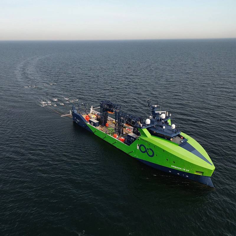
Ocean Infinity completed a first of its kind offshore wind farm survey for Ørsted and PGE in the Polish sector of the Baltic Sea. The project team based in Ocean Infinity’s Operations Centre in Gothenburg, used a multi-beam echo sounder (MBES) and 3D multi-channel ultra-high resolution seismic (3D-UHRS) equipment deployed from an Ocean Infinity Armada lean crewed vessel over 540 km to identify sub-surface boulders in support of the Baltica 2 project installation campaign for wind turbine generators (WTG) and offshore substation (OSS) locations. Key to the project's success was the use of real-time remote data management.
Ørsted and PGE operate on a 24-hour delivery schedule, necessitating data products to be produced within 24 hours of logging off. This can pose a challenge even on conventional vessels, where data is logged and processed on the same server. With Ocean Infinity’s sophisticated remote data collection system, however, the survey data was accessible to the office based processing team within the same timeframe as an offshore team would expect, enabling us to meet Ørsted's high expectations and deliver according to specification.
Kraken Completes High Res Route Survey
Kraken Robotics said it completed a contract to supply high-resolution seabed mapping sonar service to Precision Hydrographic Services (PHS), a customer supporting the Australian Department of Defense. The Australian Department of Defense project sought to undertake Hydrographic High Resolution Route Surveys (RS) for a number of Australian ports. The purpose of these surveys was to enable the collection of Maritime Geospatial Information (MGI) to support maritime domain awareness through the acquisition of high-resolution seabed foundation data and associated oceanographic data.
“Our decision to partner with Kraken Robotics and the KATFISH synthetic aperture sonar (SAS) system for this important Defence project has proven to be highly successful. Over the course of five months our team travelled non-stop from port to port and surveyed several thousand line-miles of Australia’s most important ports and waterways for Defence. The Kraken KATFISH performed faultlessly with not one hour of downtime,” said Neil Hewitt, Managing Director of Precision Hydrographic Services Pty.
Under the scope of Kraken’s contract, a KATFISH high-speed survey/detection solution was used to acquire high-resolution route surveys of Australian ports. Under the contract, the survey campaign commenced in January 2024 and was fully complete in May 2024. This contract follows the results of a successful in-country demonstration of KATFISH for the RAN in Q1 of 2023 and the purchase of a KATFISH system by the RAN in Q2, 2023.
Bringing Hydrographic Survey Data Processing to the Cloud
Terradepth will partner Hypack enable surveyors to run Hypack's software directly in the cloud through
Terradepth's Absolute Ocean platform, aiming to streamline the hydrographic survey workflow, addressing a critical challenge in the hydrographic surveying industry.
Traditionally, surveyors process data locally on laptops and face significant hurdles in receiving the data in a timely manner and then sharing that data with end users when processed, often relying on slow and inefficient methods such as file hosting services or physical hard drive shipments.
By integrating Hypack software with Terradepth's cloud-native Absolute Ocean platform, hydrographic surveyors can now process ocean data in near-real time during surveys and seamlessly contextualize it with existing geophysical data. This integration dramatically reduces the time from data collection to actionable insights, shrinking lead times from weeks to hours.
"We are very excited to share our latest innovation in ocean data processing with the integration of Absolute Ocean and HYPACK's sonar data software," said Joe Wolfel, CEO of Terradepth. "Our goal is to revolutionize the hydrographic industry, making ocean data more accessible, efficient, and actionable than ever before, and this partnership is a great example of this."
Crowdsourced Bathymetry Data Explorer Platform Debuts
FarSounder released its CSB Data Explorer, a web-based platform that enables contributors of crowdsourced bathymetry (CSB) data to see where they’ve made contributions and gauge their support of the CSB community. This tool provides a visualization of where your vessel or vessels are making a difference in the daunting task of mapping the world’s oceans.
The CSB Data Explorer is designed as a simple to use dashboard enabling users to view their contributions and monitor statistics highlighting the value of their individual contributions. This not only allows contributors to better understand where and how much they have donated, but it also facilitates the recruitment of other contributors via streamlined functionality to share their stats on social media. Additionally, in an effort to provide additional motivation through gamification, contributors can compare their contributions to the overall FarSounder fleet’s contributions and view the entire International Hydrographic Organization’s (IHO) CSB database on top of a global map.
The CSB Data Explorer.has been created in partnership with the International SeaKeepers Society, the IHO, and The Nippon Foundation-GEBCO Seabed 2030 Project.
