Technology Update
Sub-Bottom Profilers
Profiling Change
Sub-bottom profilers are tracking offshore wind into deeper water, but there’s other opportunities too that are driving the latest developments.
By Wendy Laursen
Kongsberg Discovery’s SBP29 data identifying sediment layers down to 400m at around 1800 meters water depths.
Image courtesy Kongsberg DiscoveryBahrain's coastline has expanded significantly in the past 30 years, while Abu Dhabi actively pursues new land development through the creation of massive artificial islands.
Sub-bottom profilers have and will be crucial in projects like these, says Richard Dowdeswell, CCO at GeoAcoustics. “Offshore construction, particularly for land reclamation projects like ports and harbors, is a growing market. Before any construction begins, it’s essential to understand the area's geology, which feeds into the civil and marine engineering plans. Most of this activity happens in shallow coastal waters.”
The growing demand for geophysical surveys, particularly for wind farm development, is another key driver, says Dowdeswell, and this is increasingly encompassing deeper waters. “Wind farms require knowledge of subsurface conditions, especially for laying interconnecting and export cables. When operating cable trenching machines, it’s critical to identify potential obstacles like large boulders that could damage the expensive equipment. This is where more powerful sub-bottom profilers, along with traditional seismic boomers and sparkers, come into play. These tools, which operate at lower frequencies with more power, help detect deeper subsurface features and harder surfaces, such as compacted sand, revealing objects and the geology of the strata.”
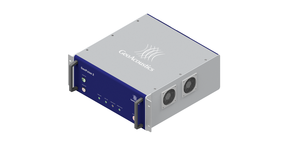
The company’s latest development extends depth range. “The GeoPulse Compact is an excellent tool for shallow water and small boat exploration. In contrast, the GeoPulse 2 replaces the older analogue systems and operates at depths of up to 5,000 meters. It has significantly more power, making it better suited for penetrating harder sediments and reaching greater depths.”
GeoPulse 2 offers digital Chirp and Ricker waveforms, in addition to pinger functionality. These new waveforms offer enhanced resolution and advantages depending on the geological conditions and water depth. Despite these upgrades, GeoPulse 2 is designed to be a simple drop-in replacement – users don't need to replace their existing GeoPulse cabling or transducer, and it’s compatible with systems like Chesapeake Technology’s SonarWiz, Xylem Water Solutions’ Hypack, and GeoMarine’s Geo All Suite.
 Image courtesy Kongsberg DiscoveryThe need for automated solutions to ensure data quality is becoming more important. - Therese Mathisen, Product Manager for Sub-bottom Profilers, Kongsberg Discovery
Therese Mathisen, product manager for sub-bottom profilers at Kongsberg Discovery, points to the trend towards smaller vessels and automated survey platforms. Saving space and power consumption are important factors. Contradicting these needs, operation at deep water requires providing greater penetration and resolution through a low and wide frequency range, high source level and narrow beams - which typically involve physically larger installations.
“The need for automated solutions to ensure data quality is becoming more important. Aided and automated survey settings are important to avoid making costly mistakes that requires re-runs, or even revisiting a survey area. The user may want data in near real time for their decisions makings. Cloud based solutions giving the user necessary information is certainly an important means to allow for sharing the data in an efficient manner,” says Mathisen.
“The need for meeting practical solutions such as installation space, power requirements, remote operations, as well as robustness against user mistakes at the same time as providing expert users with high flexibility, is technologically challenging, but yet interesting and very understandable.”
Kongsberg Discovery’s sub-bottom profiling systems include the SBP29, a high power, narrow beam sub-bottom system that operates together with the deepwater Kongsberg multibeam systems. It operates at 2-9 kHz and can acquire several simultaneous narrow beam sub-bottom observations in a fan across the vessel. In real-time it will pick the strongest reflection and generate a multibeam sub-bottom image from several high resolution, narrow beams.
The TOPAS is a family of parametric sub-bottom profiling systems available in configurations from shallow waters to full ocean depths. The benefit of the parametric principle is that it can acquire high quality sub-bottom data with smaller transducer arrays.
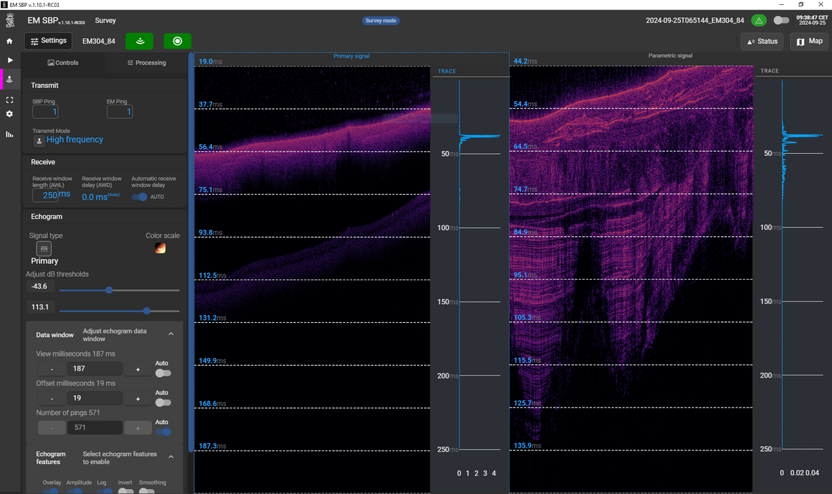
EM SBP is Kongsberg Discovery’s newest sub-bottom profiling solution. EM SBP uses the EM 124 or the EM 304 multibeam echo sounder hardware which for many larger survey vessels already are available on board for bathymetry purposes. “EM®SBP allows you to use your multibeam system for sub-bottom data acquisition and by that adding information and value to your seabed survey at low cost, low space and low power consumption,” says Mathisen.
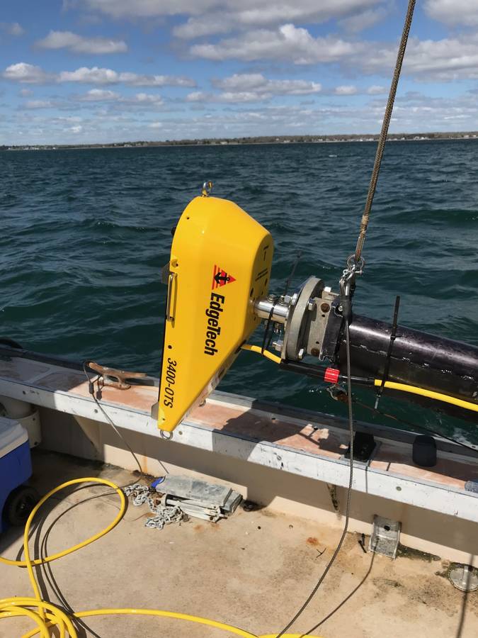
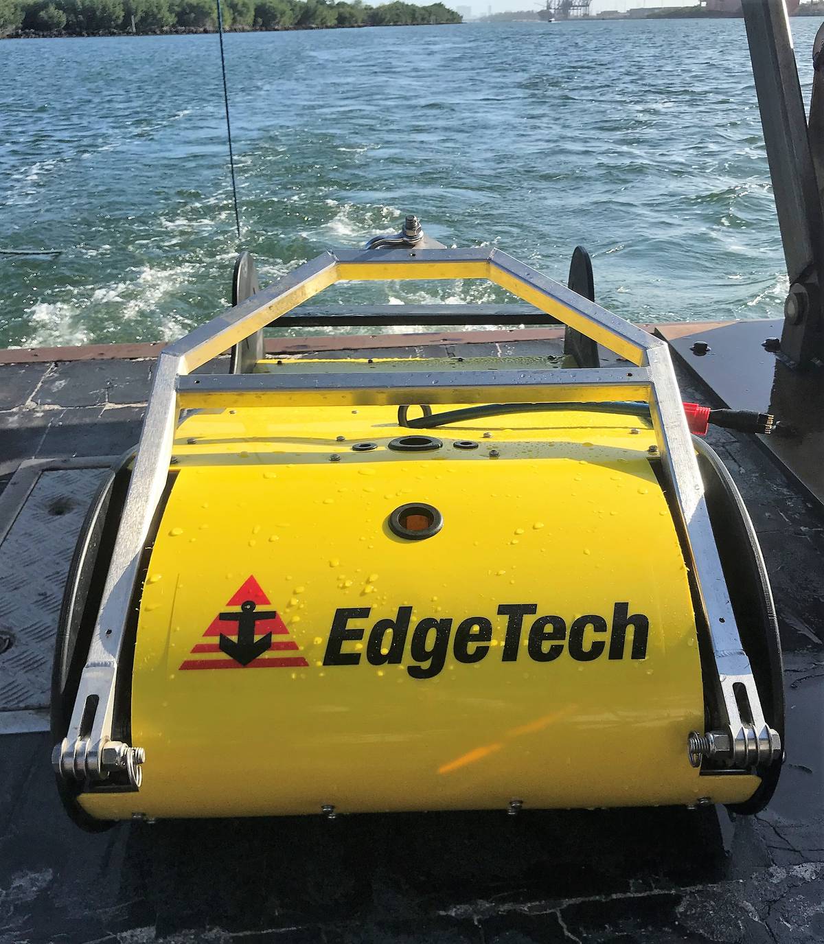
EdgeTech’s 3400 systems now have PVDF receivers and “pipeline mode.” The 3400-OTS transmits wide band frequency modulated pulses utilizing the company’s proprietary full spectrum CHIRP technology. The system uses flat multi-channel hydrophone array to generate high resolution images of the sub-bottom stratigraphy in oceans, lakes and rivers and provides excellent penetration in various bottom types, says Doug McGowen, Director, Sales and Marketing at EdgeTech.
The 3400-OTS receiver array is segmented for standard sub-bottom profiling operations or “pipeline” mode for optimal location and imaging of buried pipelines or cables. The system offers real-time reflection coefficient measurements. “This unique ability of the EdgeTech sub-bottom profiler system allows users the ability to collect complex analytic data using linear system architecture to measure sediment reflection and analyze sediment type determination,” says McGowen. Additionally, the system has discrete transmit and receive channels allowing for continuous data collection resulting in a high ping rate, particularly important for construction and pipeline surveys.
At the high end of the market, EdgeTech has just started to deploy the buried object sonar system (eBOSS) which is capable of penetrating the seabed to accurately detect, locate, classify and identify buried and partially proud objects. This low-frequency acoustic imaging system can be operated in real-time for general survey purposes such as cable and pipe tracking and route surveys or have the data post processed utilizing synthetic aperture sonar processing to render 3-dimensional images of buried objects.
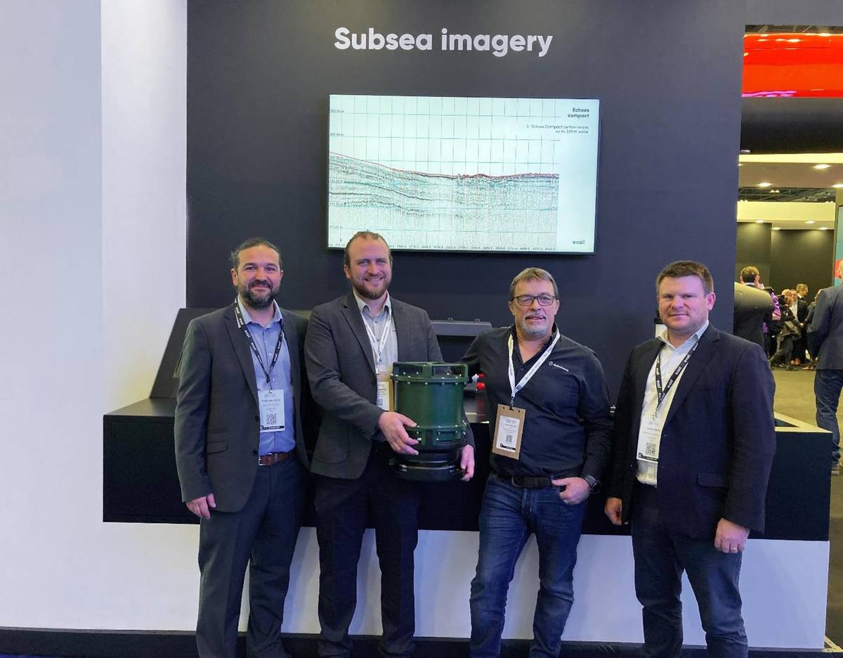
Exail’s new Echoes Compact provides high-resolution images of sedimentary deposits and buried objects across a depth range from very shallow waters to 400m. The system is specifically designed for USVs and small vessels as it features low power consumption and compact dimensions. It is a portable solution suited to river, lake and ocean surveys, whatever the seabed topography. Exail says it offers good penetration of clays and sands due to its powerful low-frequency signal, together with 7.5cm vertical resolution thanks to a wide bandwidth from 5 to 15kHz.
Exail sold its first Echoes Compact to Hydroconsult. The company is serving as a consultant and personnel provider to a major multi-energy firm in Africa which is analyzing the sub-bottom before the installation of telecommunication cables and pipelines in West Africa.